Negros Island · Visayas
Mt. Talinis (Cuernos de Negros)
1,903 m above sea level · Negros Oriental · 9.245°N, 123.178°E · effort 6/9
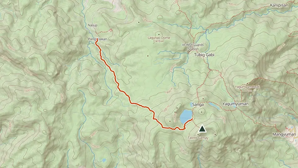
The "Horns of Negros" above Dumaguete and Valencia, a cluster of forested spires cradling crater lakes Yagumyum and Nailig. Sulfur vents, tree ferns and lakeshore camps make it a Visayan favorite.
Access and permits
Permit required
Guide required for the approach described below.
Valencia's tourism officer describes Ordinance 4/2020 requiring a permit, registered entry checkpoints and a hired local guide for Valencia approaches. 2022 closure is older than this enforcement report; current-day reopening, original ordinance and prices not verified.
Arrange with: Valencia LGU / ENRO, Negros Oriental
Research checked 2026-09-08. Source date: 2025-03-24. Current access and fees must be confirmed before travel.
PNA / Valencia tourism officer — Negros Oriental town tightens regulations in Mt. Talinis
Trails
| Trail | Jump-off | Effort | Technical | Distance | Time |
|---|---|---|---|---|---|
| Apolong Trail | Brgy. Apolong, Valencia, Neg. Or. | 6/9 | C | ~17 km (estimated, no mapped route) | 2 days |
| Bediao Trail | Brgy. Bediao, Valencia, Neg. Or. | 6/9 | C | ~15 km (estimated, no mapped route) | Overnight |
Effort (1-9) is computed from distance, ascent and terrain; technical (A-E) follows the trail class, from a clear path (A) to real climbing (E). Elevations, grades and trail data are indicative - always verify with the LGU / DENR before a climb. Routes come from OpenStreetMap and can be partial or outdated; a mapped line does not prove a safe or open path.
Take Mt. Talinis (Cuernos de Negros) offline
Bundok ng Pinas keeps a personal climb log, records your track with the screen off, saves this mountain's topographic map for use without signal and shows the same access notes on the trail. No account needed.
Ask about availability
Tell us your device and country for the latest access options.
Email about accessNearby mountains
- Mt. Lanaya 700 m · 55 km away
- Osmeña Peak 1,013 m · 70 km away
- Linabo Peak 460 m · 77 km away