Calabarzon · Luzon
Mt. Cristobal
1,470 m above sea level · Quezon, Laguna · 14.064°N, 121.427°E · effort 6/9
Access and permits
Access restricted
DENR ranger interviewed in February 2026 says Banahaw and San Cristobal remain off limits. Foothill pilgrimage permissions do not authorize summits. Not verified: original protected-area notice; no reopening found.
Arrange with: Local tourism office and protected-area office for the intended approach
Research checked 2026-09-08. Source date: 2026-02-21. Current access and fees must be confirmed before travel.
Delfin Mallari / Inquirer — Mt. Banahaw stays closed as Lent begins
Banahaw's dark twin - the so-called "Devil's Mountain" of hiker folklore - with a beautiful, bird-rich forest trail to a crater-rim clearing. Spooky reputation, genuinely lovely climb.
Trails
| Trail | Jump-off | Effort | Technical | Distance | Time |
|---|---|---|---|---|---|
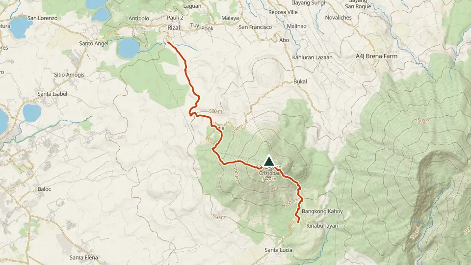
| Montelibano Trail | Brgy. Sta. Lucia, Dolores, Quezon | 6/9 | C | ~23.8 km (estimated, no mapped route) | Day hike (~6-9 h moving) |
Effort (1-9) is computed from distance, ascent and terrain; technical (A-E) follows the trail class, from a clear path (A) to real climbing (E). Elevations, grades and trail data are indicative - always verify with the LGU / DENR before a climb. Routes come from OpenStreetMap and can be partial or outdated; a mapped line does not prove a safe or open path.
Take Mt. Cristobal offline
Bundok ng Pinas keeps a personal climb log, records your track with the screen off, saves this mountain's topographic map for use without signal and shows the same access notes on the trail. No account needed.
Ask about availability
Tell us your device and country for the latest access options.
Email about accessNearby mountains
- Tayak Hill 660 m · 2 km away
- Mt. Banahaw 2,170 m · 7 km away
- Mt. Kalisungan 629 m · 13 km away