Central Luzon · Luzon
Mt. Pinatubo
1,486 m above sea level · Zambales, Tarlac, Pampanga · 15.145°N, 120.349°E · effort 3–7/9
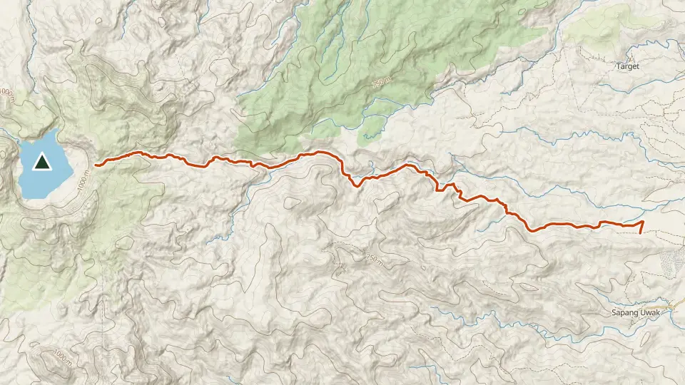
Site of the cataclysmic 1991 eruption, now holding a surreal turquoise crater lake ringed by ash canyons. The standard trip crosses lahar fields by 4x4 before a short canyon walk to the rim.
Access and permits
Permit required
Guide required for the approach described below.
The 2025 Capas charter specifies accredited-operator booking, blood-pressure checks from age 40, a medical certificate from age 60, and parental waivers for minors. This covers the Capas approach. Confirm current conditions and separately itemized vehicle, guide and municipal charges; no September 2026 tariff verified.
Arrange with: Sta. Juliana tourism office, Capas, Tarlac
Research checked 2026-09-08. Source date: 2025. Current access and fees must be confirmed before travel.
Trails
| Trail | Jump-off | Effort | Technical | Distance | Time |
|---|---|---|---|---|---|
| Sta. Juliana (Capas) Trail | Brgy. Sta. Juliana, Capas, Tarlac | 3/9 | A | ~14 km (estimated, no mapped route) | Day trip (2 h walk) |
| Delta 5 Trail | Sta. Juliana (Delta 5), Capas, Tarlac | 7/9 | A | 35.5 km out-and-back | Day trip (~5-6 h walking) |
Effort (1-9) is computed from distance, ascent and terrain; technical (A-E) follows the trail class, from a clear path (A) to real climbing (E). Elevations, grades and trail data are indicative - always verify with the LGU / DENR before a climb. Routes come from OpenStreetMap and can be partial or outdated; a mapped line does not prove a safe or open path.
Take Mt. Pinatubo offline
Bundok ng Pinas keeps a personal climb log, records your track with the screen off, saves this mountain's topographic map for use without signal and shows the same access notes on the trail. No account needed.
Ask about availability
Tell us your device and country for the latest access options.
Email about accessNearby mountains
- Mt. Balingkilat 1,100 m · 40 km away
- Mt. Pundaquit 630 m · 40 km away
- Mt. Arayat 1,030 m · 43 km away