Cordillera (CAR) · Luzon
Mt. Napulauan
2,642 m above sea level · Ifugao · 16.831°N, 120.961°E · effort 7/9
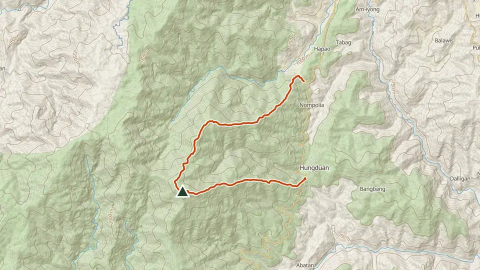
Hungduan's "whitened" mountain, often capped in fog, with a brutally steep ascent through enchanting moss-covered forest. Yamashita's forces retreated over its slopes at the end of WWII.
Access and permits
Before you go
The tourism map names Napulauan but explicitly provides basic tourism context only. Its URL directory says 2023; the retrieved map says March 2025. It does not establish entry, guide, camping or traverse rules.
Arrange with: Hungduan municipal tourism office and the barangay for the intended ascent or traverse
Research checked 2026-10-26. Source date: March 2025 printing. Current access and fees must be confirmed before travel.
Trails
| Trail | Jump-off | Effort | Technical | Distance | Time |
|---|---|---|---|---|---|
| Hungduan Trail | Poblacion, Hungduan, Ifugao | 7/9 | C | 13.1 km traverse | Overnight (~7–11 h moving) |
Effort (1-9) is computed from distance, ascent and terrain; technical (A-E) follows the trail class, from a clear path (A) to real climbing (E). Elevations, grades and trail data are indicative - always verify with the LGU / DENR before a climb. Routes come from OpenStreetMap and can be partial or outdated; a mapped line does not prove a safe or open path.
Take Mt. Napulauan offline
Bundok ng Pinas keeps a personal climb log, records your track with the screen off, saves this mountain's topographic map for use without signal and shows the same access notes on the trail. No account needed.
Available to download
Check Google Play for your device and country · listing checked 2026-11-09
Nearby mountains
- Mt. Kapugan 1,305 m · 14 km away
- Mt. Kalawitan 2,714 m · 15 km away
- Mt. Tabayoc 2,842 m · 18 km away