Bicol Region · Luzon
Mt. Mayon
2,463 m above sea level · Albay · 13.256°N, 123.686°E · effort 7–8/9
Access and permits
Access restricted
September 8 PHIVOLCS bulletin prohibits entry into Mayon's six-kilometre permanent danger zone, which includes the summit. No inference of permission outside the exclusion zone; check subsequent advisories.
Arrange with: PHIVOLCS and relevant protected-area / local authorities
Research checked 2026-09-08. Source date: 2026-09-08. Current access and fees must be confirmed before travel.
The world's most perfect volcanic cone and Bicol's restless icon. Climbs - when PHIVOLCS permits - cross lava gullies and loose cinder at a punishing grade; most parties turn at the permitted altitude line.
Trails
| Trail | Jump-off | Effort | Technical | Distance | Time |
|---|---|---|---|---|---|
| Buyuan (Southeast) Trail | Brgy. Buyuan, Legazpi City, Albay | 8/9 | D | ~18 km (estimated, no mapped route) | 2 days (permit-dependent) |
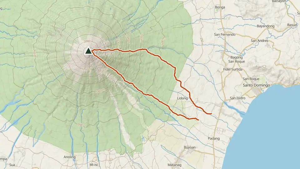
| New Lidong Trail | Brgy. Lidong, Sto. Domingo, Albay | 8/9 | D | 19.9 km out-and-back | 2 days (permit-dependent) |
| Traditional (Buyuan) Trail | Brgy. Buyuan, Legazpi City, Albay | 7/9 | D | 16.5 km out-and-back | 2 days (permit-dependent) |
Effort (1-9) is computed from distance, ascent and terrain; technical (A-E) follows the trail class, from a clear path (A) to real climbing (E). Elevations, grades and trail data are indicative - always verify with the LGU / DENR before a climb. Routes come from OpenStreetMap and can be partial or outdated; a mapped line does not prove a safe or open path.
Take Mt. Mayon offline
Bundok ng Pinas keeps a personal climb log, records your track with the screen off, saves this mountain's topographic map for use without signal and shows the same access notes on the trail. No account needed.
Ask about availability
Tell us your device and country for the latest access options.
Email about accessNearby mountains
- Mt. Masaraga 1,328 m · 11 km away
- Mt. Malinao 1,548 m · 18 km away
- Mt. Iriga (Asog) 1,196 m · 33 km away