Mimaropa · Luzon
Mt. Mantalingajan
2,085 m above sea level · Palawan · 8.818°N, 117.675°E · effort 9/9
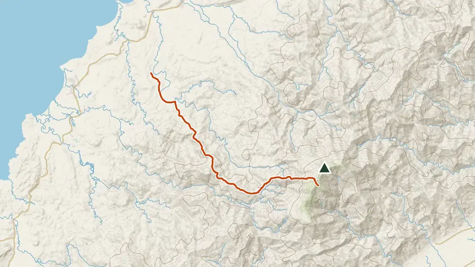
The remote "Mountain of God" at Palawan's southern spine, a multi-day expedition through Pala'wan tribal lands, bamboo forests and wind-scoured summit ridges. Logistics alone make it a major undertaking.
Access and permits
Before you go
Proclamation 1815 establishes DENR administration with PCSD partnership and preserves Indigenous rights. Rizal LGU alone is not established as sole approving authority; visitor sequence and current access unknown.
Arrange with: DENR protected-area office, PCSD, relevant LGU and Indigenous community
Research checked 2026-09-08. Source date: 2009-06-23. Current access and fees must be confirmed before travel.
Philippine Presidency, reproduced by Lawphil — Proclamation 1815
Trails
| Trail | Jump-off | Effort | Technical | Distance | Time |
|---|---|---|---|---|---|
| Ransang Trail | Brgy. Ransang, Rizal, Palawan | 9/9 | D | 50 km out-and-back (route partly mapped) | 4-5 days |
Effort (1-9) is computed from distance, ascent and terrain; technical (A-E) follows the trail class, from a clear path (A) to real climbing (E). Elevations, grades and trail data are indicative - always verify with the LGU / DENR before a climb. Routes come from OpenStreetMap and can be partial or outdated; a mapped line does not prove a safe or open path.
Take Mt. Mantalingajan offline
Bundok ng Pinas keeps a personal climb log, records your track with the screen off, saves this mountain's topographic map for use without signal and shows the same access notes on the trail. No account needed.
Ask about availability
Tell us your device and country for the latest access options.
Email about accessNearby mountains
- Victoria Peak 1,726 m · 93 km away
- Cleopatra's Needle 1,593 m · 205 km away
- Mt. Aguado 160 m · 431 km away