Mimaropa · Luzon
Mt. Malindig
1,174 m above sea level · Marinduque · 13.241°N, 122.013°E · effort 4/9
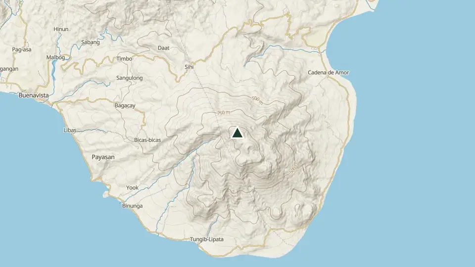
Marinduque's highest point and its landmark cone, rising straight out of the sea at the island's southern tip. A military detachment sits partway up; the upper cone is forest and rock.
Access and permits
Before you go
The original source could not be retrieved in this review; only indexed context was available. The provincial page mentions Malindig as a view from Poctoy Beach. Beach tourism does not establish summit permission, radio-site access, guide rules or fees.
Arrange with: Buenavista municipal tourism office, Marinduque, and Sihi barangay authorities
Research checked 2026-10-26. Source date: undated. Current access and fees must be confirmed before travel.
Trails
| Trail | Jump-off | Effort | Technical | Distance | Time |
|---|---|---|---|---|---|
| Sihi Trail | Brgy. Sihi, Buenavista, Marinduque | 4/9 | B | ~11 km (estimated, no mapped route) | Day hike (~3–4 h ascent) |
Effort (1-9) is computed from distance, ascent and terrain; technical (A-E) follows the trail class, from a clear path (A) to real climbing (E). Elevations, grades and trail data are indicative - always verify with the LGU / DENR before a climb. Routes come from OpenStreetMap and can be partial or outdated; a mapped line does not prove a safe or open path.
Take Mt. Malindig offline
Bundok ng Pinas keeps a personal climb log, records your track with the screen off, saves this mountain's topographic map for use without signal and shows the same access notes on the trail. No account needed.
Available to download
Check Google Play for your device and country · listing checked 2026-11-09
Nearby mountains
- Mt. Pinagbanderahan 366 m · 87 km away
- Mt. Daguldol 672 m · 89 km away
- Mt. Lobo 980 m · 90 km away