Calabarzon · Luzon
Mt. Makiling
1,090 m above sea level · Laguna, Batangas · 14.133°N, 121.197°E · effort 4–6/9
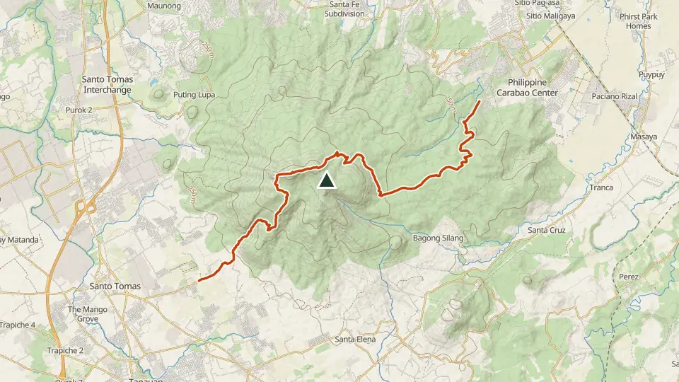
The legendary home of Mariang Makiling and a living laboratory of UPLB's forest reserve. The classic UPLB trail is a gentle forest walk; the Sto. Tomas (MakTrav) side adds ropes, roots and the "Wild Boar" spur.
Access and permits
Before you go
UPLB's community publication describes required eco-guides for Peak II in 2025, with an explicitly dated Holy Week exception. Current MCME rule and fees, and Sto. Tomas traverse access unverified; generic guide-recommended claim unsupported.
Arrange with: Makiling Center for Mountain Ecosystems (UPLB)
Research checked 2026-09-08. Source date: 2025-05-02. Current access and fees must be confirmed before travel.
Los Banos Times, UPLB community publication — Make it Makiling 2025, umarangkada
Trails
| Trail | Jump-off | Effort | Technical | Distance | Time |
|---|---|---|---|---|---|
| UPLB Trail (Peak 2) | UPLB College of Forestry, Los Baños | 4/9 | B | ~19.4 km (estimated, no mapped route) | Day hike (4-5 h up) |
| MakTrav (Sto. Tomas Traverse) | Brgy. San Felix, Sto. Tomas, Batangas | 6/9 | C | 14.5 km traverse | Day hike (~6-9 h moving) |
Effort (1-9) is computed from distance, ascent and terrain; technical (A-E) follows the trail class, from a clear path (A) to real climbing (E). Elevations, grades and trail data are indicative - always verify with the LGU / DENR before a climb. Routes come from OpenStreetMap and can be partial or outdated; a mapped line does not prove a safe or open path.
Take Mt. Makiling offline
Bundok ng Pinas keeps a personal climb log, records your track with the screen off, saves this mountain's topographic map for use without signal and shows the same access notes on the trail. No account needed.
Ask about availability
Tell us your device and country for the latest access options.
Email about accessNearby mountains
- Mt. Manabu 760 m · 16 km away
- Mt. Kalisungan 629 m · 16 km away
- Mt. Malipunyo 980 m · 19 km away