Davao Region · Mindanao
Mt. Apo
2,954 m above sea level · Davao del Sur, North Cotabato · 6.987°N, 125.271°E · effort 6–8/9
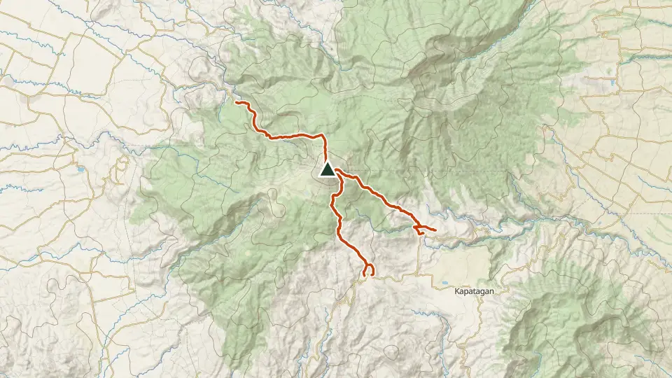
The grandfather of Philippine mountains and the nation's highest point. Sulfur vents, the vast summit boulder field, Lake Venado's mirror flats and the old crater make every route a grand tour.
Access and permits
Before you go
DENR-attributed reporting gives the annual June 1–August 31 closure; the end date does not itself verify September reopening. September reopening and every trailhead's documents, guides and rates require confirmation.
Arrange with: LGU of your trailhead (Kidapawan / Sta. Cruz / Digos)
Research checked 2026-09-08. Source date: 2026-06-01. Current access and fees must be confirmed before travel.
Mindanao Times / DENR XI — Mt. Apo closed to climbers until Aug.31
Trails
| Trail | Jump-off | Effort | Technical | Distance | Time |
|---|---|---|---|---|---|
| Kidapawan Trail | Brgy. Ilomavis, Kidapawan, N. Cotabato | 8/9 | D | 16.8 km out-and-back | 2-3 days (~7-10 h moving) |
| Sta. Cruz Trail | Brgy. Sibulan, Sta. Cruz, Davao del Sur | 6/9 | C | 14.7 km traverse | 3 days |
| Kapatagan (Digos) Trail | Brgy. Kapatagan, Digos, Davao del Sur | 7/9 | C | ~28 km (estimated, no mapped route) | 2-3 days |
| Baroring Trail | Sitio Baroring, Calinan District, Davao City | 6/9 | C | 16 km out-and-back | 2-3 days |
| Culan Trail | Sitio Culan, Kapatagan, Digos, Davao del Sur | 7/9 | C | 15.1 km out-and-back | 2-3 days |
Effort (1-9) is computed from distance, ascent and terrain; technical (A-E) follows the trail class, from a clear path (A) to real climbing (E). Elevations, grades and trail data are indicative - always verify with the LGU / DENR before a climb. Routes come from OpenStreetMap and can be partial or outdated; a mapped line does not prove a safe or open path.
Take Mt. Apo offline
Bundok ng Pinas keeps a personal climb log, records your track with the screen off, saves this mountain's topographic map for use without signal and shows the same access notes on the trail. No account needed.
Ask about availability
Tell us your device and country for the latest access options.
Email about accessNearby mountains
- Mt. Talomo 2,674 m · 8 km away
- Mt. Puting Bato 410 m · 56 km away
- Mt. Matutum 2,286 m · 73 km away